Background and General Introduction
Note 1. The subject of this study is variously written as either “Enclosure” or “Inclosure”. The former is the modern form and is used in the text except where an original document is referenced, in which case the latter spelling, current at the turn of the 18th century, is used.
Note 2. The links below lead to more detail, in downloadable pdf files:
The Tysoe Inclosure Act 1796
Glossary of Terms
The enclosure of open fields and commons had been going on quietly and slowly in many parishes in England in the 15th and 16th centuries, if not before. These enclosures were either achieved by informal agreement between landowners, or by formal agreements ratified in a court of law. In Tysoe these types of enclosure are described in the documents which are the subject of this study as ‘Old Inclosures’ or ‘Ancient Inclosures’. They are to be found over much of the parish north of the A422, around Hardwick Farm, Brixfield Farm and Upper and Lower Westcote, as well as in isolated pockets elsewhere.
But by the end of the 18th century the remainder of the land in the parish remained unenclosed in open fields, commons, wastes and meadows. While we can infer some information from our existing study of field names and the evidence of ridge and furrow in fields around the village, we now have documentary evidence of the pre-enclosure layout of Tysoe. The following photograph is just one of twenty map extracts showing the Earl of Northampton’s Estate as it was in 1770. It shows the density of the strips in the open fields and parts of the common land. There is much work still to do based on this source.

Figure 1 Lord Northampton Estate c1770
For the time being, this study focuses on the enclosures which followed the private Act of Parliament known as the Tysoe Inclosure Act 1796. Enclosure by Act of Parliament was occurring throughout the Midlands during the 18th century, and it is Parliamentary enclosure that we usually have in mind when we recognise changes to the landscape brought about by the planting of hedges around parcels of land and the existence of unusually straight roads.
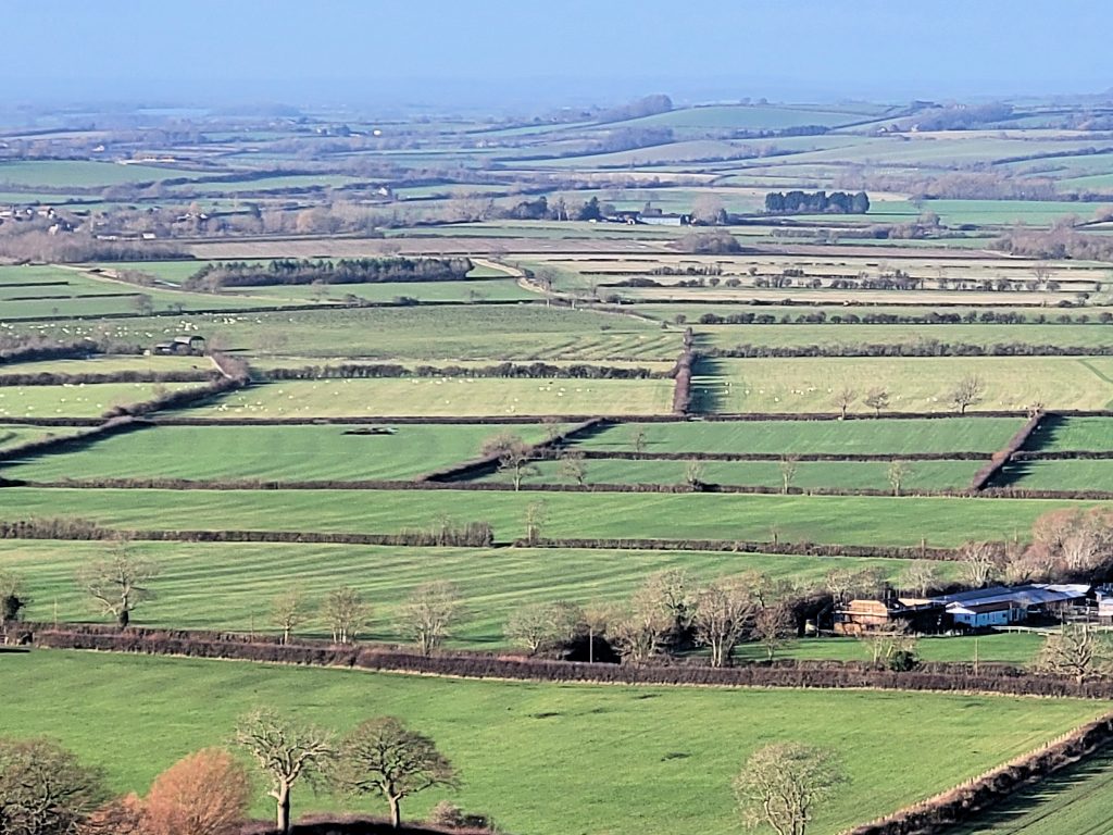
Figure 2 View from Sun Rising Hill of post-enclosure fields
But its far less visible consequences were at least as important, as agricultural production was, in effect, revolutionized. Prior to enclosure, “farms” would have comprised strips of arable land, sometimes as many as fifty, distributed throughout the open unfenced fields. They had to be farmed in accordance with the decisions made annually by the Court Leet (qv) or manorial court. So ‘farmers’ had to sow crops in rotation, including a fallow period, and graze animals at agreed times of the year and in agreed places. In addition, the use of the common land, whether for grazing, fuel gathering, or cutting of turf was similarly governed by strict rights held by individuals. The origin of those rights was often obscure.
Finally, proprietors and tenants of land and some of those with common rights or strips in the arable fields paid tithes to the vicar or rector of the parish for the support of the clergy and church, or to a lay person. Thus, every man or producer had to farm in concert with his neighbours, and many, in exercising their common rights, relied to some extent on the use of land not his own. In other words, agricultural production had to be managed communally and co-operatively.
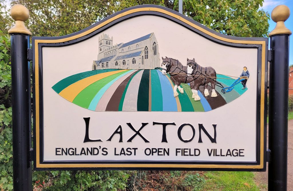
Figure 3 Laxton village sign board
Although we have not yet studied the pre-enclosure layout of Tysoe’s open fields and commons, we can look elsewhere for enlightenment. Laxton in Nottinghamshire claims to be the only parish in England in which the open-field system survives, albeit slightly modified in the early 20th century, when some of the original narrow strips (or yardlands qv) were consolidated to allow the use of contemporary machinery.
The Court Leet (qv) in Laxton still exists and farmers there still meet to decide the course of husbandry in the open fields and then work co-operatively to farm the land. It is noticeable that all the farmsteads are still within the village, as there has been no incentive to move the farmhouse and buildings out of the village to privately owned land at the centre of a consolidated holding.
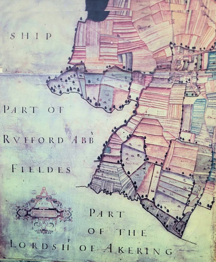
Figure 4 A map of Laxton made by Mark Pierce in 1635 shows the arrangement of strips in part of the parish
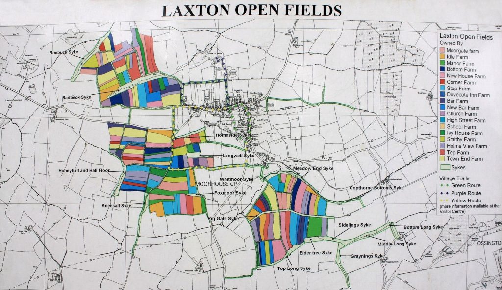
Figure 5 The Laxton Village Visitor Centre has a modern interpretation of the original open field system
It is probably safe to assume that pre-enclosure Tysoe would have resembled the pattern that can still be seen in Laxton. Indeed, we can still see some farmsteads, such as Mill Farm and Herberts Farm, in the centre of the three townships that comprise modern Tysoe.
So, who owned the commons, open fields and other land in a pre-enclosure parish, such as Tysoe? The Lord of the Manor, either resident locally or an absentee landlord, nominally owned the soil of the Manor. Other ‘farmers’, either gentleman farmers or yeomen, held land either as freeholders or copyholders (qv). Cottagers (qv) were usually tenants of these landholders.
But discrete groups did not necessarily exist, and it is difficult to disentangle the range of land tenures and social strata, as boundaries between them are often blurred. Many farmers held both freehold and copyhold land. Some commoners with a right of pasture on the common might also have held strips in the open arable fields. Any of these ‘proprietors’ may also have been required to pay or were entitled to receive tithes.
One historian (J A Martin) has argued that, in the Feldon, even where men did not occupy any open field strips, they might still obtain a high proportion of their income from the land because of the prevalence of customary rights of usage of the common and waste, the remainder of their income being made up by day-labouring or a trade such as shoemaking. So even landless men had a vested interest in the process of enclosure and what it would mean to them.
It was often argued in the 18th and 19th centuries that the process of enclosure presented the opportunity to improve agricultural productivity, since the consolidation of ownerships could, for instance, allow for drainage improvements, and the planting of hedges could allow controlled stock breeding. Enclosure could, and usually did, result in the commutation of tithes, as those entitled to receive tithes were compensated by the allocation of freehold land. Boundary disputes could be settled once and for all, as could matters of unauthorized encroachment on common land. All these matters have, at some time or other, been cited as positive outcomes of enclosure.